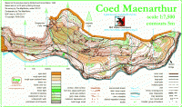
Coed Maenarthur
Steep Forestry Commission woodland with crags and contour features in abundance, approximately 2000 meters long by 800 meters wide. Bordered on its southern area by a river which runs along ite entire length.
Location
Nearest town: Pont-rhyd-y-groes
- Grid Ref:
- Postcode: SY25 6DS
- Latitude: 52.33610
- Longitude: -3.86158
- Google Map (aerial) - Bing Map (OS)
Last edited: 12th Nov 11
