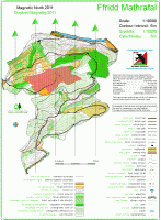
Ffridd Mathrafal
Terrain description
This is a Forestry Commission plantation with some very runnable bits and some areas of rough terrain (bramble bashers advised – but not like the man-eating brambles of Allt Fedw!) and a network of gravel forest roads and paths.
1:10000
The current map is based on the Garri Owen 1990 map with survey and cartography updates by Rod Postlethwaite of WRE in 2008 and minor revisions by Bill Marlow in 2011.
Location
Nearest town: Llanfair Caereinion
- Grid Ref: SJ116111
- Postcode: SY22 6JW
- Latitude: 52.69106
- Longitude: -3.30896
- Google Map (aerial) - Bing Map (OS)
Last edited: 11th Nov 11
