Llyn Connach
Date of event: Sun 05th Jun 2016
Level of event: Local (D)
Nearest town: Talybont Ceredigon
Results
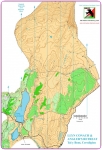
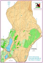
The area is upland near Anglers' Retreat. It is a newly mapped area for orienteering with extensive views into the distance from the higher vantage points as well as down towards the lakes and valleys nearby. Recent adjacent clear felling of trees has opened up the view on the approach to the area.
There are plenty of contour features and a scattering of crags throughout. The northern section is completely open. It has not been well grazed and so is rough, this will give mostly slow running. The middle section is mostly slow run forest and open. It encompasses Llyn Conach and the smaller Llyn Dwfn. The smaller Southern open area is well grazed and fast running.
Location:
- Nearest town: Talybont Ceredigon
- Grid Ref: SN741926
- Postcode:
- Latitude: 52.51674
- Longitude: -3.85606
- Google Map (aerial) - Bing Map (OS)
Officials:
- Planner: Robert Griffiths
- Organiser: Robert Griffiths
- Controller:
Image Gallery
Click the image for a larger version.
Please note: when entering our events your name may appear in the results section of this website or in newspaper reports.
Read our privacy policy to see how we look after your personal data.
Posted by Terry Smith

