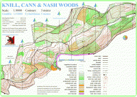
Nash Woods

Date of event: Sun 11th May 2014
Level of event: District (C)
Nearest town: Presteigne
Results
Full Results (amended on 12/05/14)
Yvette Baker Team Results
Following a discussion between the Planner and Controller it was decided to omit Leg 5 and 6 on Brown in the interest of "fairness" as it affected several competitors. One person was affected on the Blue course and she has been "credited" with this control. The Planner and Controller wish to apologise for the error in the misplacing of No.158 and hope that it didn't detract from your overall enjoyment.
Bill Marlow
Si Co-ordinator (East)
The terrain is mainly wooded with conifer and deciduous trees situated on a hill which runs the length of the area, with steep sections in places. The ridge of the hill runs west to east with the north side in Wales and the south side in England. The conifer areas are covered in brashings (small cut branches), which makes running difficult; the deciduous areas have varying degrees of undergrowth. The area has a number of forestry tracks and numerous paths some indistinct.
Runners need to be aware that the area is popular with other users, walkers with dogs, horse riders and mountain bikers so when crossing tracks or paths please take care.
This event will also incorporate the Welsh Regional Yvette Baker competition for juniors orienteers, teams from Welsh clubs and BOK will be represented.
Location:
- Nearest town: Presteigne
- Grid Ref:
- Postcode:
- Latitude: 52.26592
- Longitude: -3.00636
- Google Map (aerial) - Bing Map (OS)
Officials:
- Planner: Stuart Rees
- Organiser: Stuart Rees / Terry Smith
- Controller: Robert Griffiths
Info for dog owners
Dogs allowed under control
Facilities
There will be one portaloo situated at the assembly area, other toilets are available at the Leisure Centre. Drinks and snacks are also available from the vending machines at the Leisure Centre. The Welsh Junior Squad will be providing a stall for the sale of cakes and hot drinks. All proceeds will be used to support the continuation of coaching young up and coming orienteers.
About the area/map
Nash Woods
The area is very popular with walkers, horse riders, mountain bikers and runners. But most of these use the main forestry tracks and some of the larger pathways, the rest of the forest is rarely accessed.
The area has been used for major League events and provides challenges to most technical abilities, testing your navigational skills as well as your map reading skills.
The terrain is mainly wooded with conifer and deciduous trees situated on a hill which runs the length of the area, with steep sections in places. The ridge of the hill runs west to east with the north side in Wales and the south side in England. The conifer areas are covered in brashings (small cut branches), which makes running difficult; the deciduous areas have varying degrees of undergrowth. The area has a number of forestry tracks and numerous paths some indistinct.
The map has been updated several times to accommodate changes after felling operations in different parts of the forest. The latest version was updated in 2018 and is now georeferenced, further small changes have been made the last being on 26th September 2021.
Read more about the Nash Woods area and map
Please note: when entering our events your name may appear in the results section of this website or in newspaper reports.
Read our privacy policy to see how we look after your personal data.
Posted by Terry Smith
